Tajo. Improvement of ecological state of the Tajo and tributaries riverside affected by the spill of kaolin, at Poveda de la Sierra and Taravilla (Guadalajara)
Tajo. Improvement of ecological state of the Tajo and tributaries riverside affected by the spill of kaolin, at Poveda de la Sierra and Taravilla (Guadalajara)
Key features of the case study
- This project is part of the National strategy for River Restoration, an initiative of the Ministry of Environment, and implemented at the Tajo basin by the Confederación Hidrográfica del Tajo.
- The zone of actuation is included in the CSI ES4240016, ZEPA ES0000092, Parque Natural del Alto Tajo y zona periférica de protección de la Microrreserva Prados Húmedos de Torremocha del Pinar.
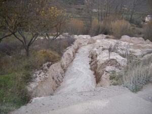
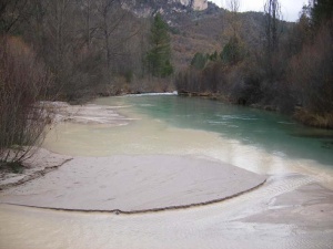
- The open air mining releases a great quantity of sediments which are incorporated into the Tajo river and its tributaries at the area between Peñalén, Poveda de la Sierra and Taravilla.Despite the construction of pools for collect the runoff and the sediment scours from the mining exploitations, some turbidity can be observed, and so deposition of fine sediments at the pools( The thickness of the sediment layer reaches 20 cm at the confluence of the Merdero stream with the Tajo). The result is the alteration of the water quality and tha availability of instream habitat.
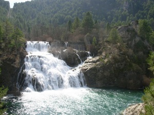
- The presence of a levee known as Salto de la Poveda makes impossible the movement upstream of the fishes, though its elimination wouldn´t be enough to enable the migration. The structure is cimented over a natural step at the longitudinal profile.
- This project is part of the National strategy for River Restoration, an initiative of the Ministry of Environment, and implemented at the Tajo basin by the Confederación Hidrográfica del Tajo.
Site description
The Alto Tajo is characterised by a network of canyons, gorges, terraces, and singular landscape shapes. This is the largest gorges system of the region, with great diversity (geologic, climatic and topograhic)and in an excellent state of preservation. this variety of environments provides a high diversity oh habitats for wildlife. Among birds of prey include: vultures, kestrels and hawks, followed by hawks, eagles and peregrine falcons.among the mammals we find: wild cats, spears, otters, polecats and weasels. Of the small mammals are the most abundant rodents: voles, house mice, dormice, squirrels, followed by insectivores.
Also remarkable is the presence of 15 species of reptiles, among them the common gecko, lizards, snakes, "lagarto ocelado" and snub-nosed viper, nine kinds of amphibians and seven native species of fish.
the vegetation of the watershed is characterised by extensive pine stands, composed of different pine species (Pynus sylvestris, Pinus nigra and Pinus Pinaster. The woods of pines are found mainly at the hillside valleys and higher elevations. Under the cover of the pine trees are oaks, holm oak and downy oak. In the center of the Alto Tajo Natural Park, at the limestone moors, are juniper forests.
The riparian forest consists of black and trembling aspen, willow, elm, linden, hazel, privet and birch among other species.
In the park there are many species that found in salt marshes, bogs, ponds and lagoons, rocky, narrow gorge, their last refuge. Examples include the Atropa baetica and Delphinium fissum subsp. sordium, the last one classified as an endangered species.
Measures selection
The main objective of the project is to improve the availability of habitats and recovery the fish populations. So, the principal measures are directed to improve the quality of the water, improve the structure and substrate of the channel and recover the longitudinal connectivity of the river.
- The establishment of buffer strips contributes to ameliorate the quantity of sediments carried with the runoff. This way, the decrease of turbidity may improve the quality of aquatic habitats and the morphology of the channel. Anyway, at the monitoring stage it has to be proved that the scope of the vegetal filters is enough to mitigate the impact of the kaolin mining.
- The instalation of a fish pass at the Salto de la Poveda would allow the migration of the fish upstream.
- Dregs and wate removal contributes to ameliorate the environmental conditions for wildlife habitats.
- The establishment of buffer strips contributes to ameliorate the quantity of sediments carried with the runoff. This way, the decrease of turbidity may improve the quality of aquatic habitats and the morphology of the channel. Anyway, at the monitoring stage it has to be proved that the scope of the vegetal filters is enough to mitigate the impact of the kaolin mining.
Other measures were used to improve the structure and composition of the vegetation (silvicultural treatments, plantations and sowing)which also helps to reduce sediment input.
Success criteria
Ecological response
Hydromorphological response
Monitoring before and after implementation of the project
Socio-economic aspects
Contact person within the organization
Ignacio Rodríguez Muñóz.
Comisario de Aguas de la Confederación Hidrográfica del Duero
e-mail: irm@chduero.es
Extra background information
References
- Factsheet of the project. Ministry of Environment. [1]
- Martín Duque, J.F., J. M. Nicolau Ibarra & C. Martín Moreno. Evaluación y corrección del impacto hidrológico de la minería del caolín en el entorno del Parque Natural del Alto Tajo. ( Hydrological impact Assessment and correction of the kaolin ining at the Alto Tajo Natural Park environment) [2] http://www.remedinal.org/plt_Page.aspx?IdObjeto=755
Related Measures
- Install fish pass/bypass/side channel for upstream migration
- Remove sediments
- Adjust land use to reduce nutrient, sediment input or shore erosion
- Develop riparian forest
- Revegetate riparian zones


