File:Map bislich.JPG
From REFORM wiki

Size of this preview: 275 × 599 pixels. Other resolution: 283 × 616 pixels.
Original file (283 × 616 pixels, file size: 27 KB, MIME type: image/jpeg)
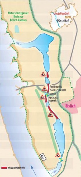
Map of planned measures in Bislich-Vahnum. Taken from NABU-Naturschutzstation e.V., Nebenstromrinne am Niederrhein
File history
Click on a date/time to view the file as it appeared at that time.
| Date/Time | Thumbnail | Dimensions | User | Comment | |
|---|---|---|---|---|---|
| current | 08:24, 7 August 2013 |  | 283 × 616 (27 KB) | Saskia.deltares (Talk | contribs) | Map of planned measures in Bislich-Vahnum. Taken from NABU-Naturschutzstation e.V., Nebenstromrinne am Niederrhein |
- You cannot overwrite this file.
File usage
The following page links to this file: